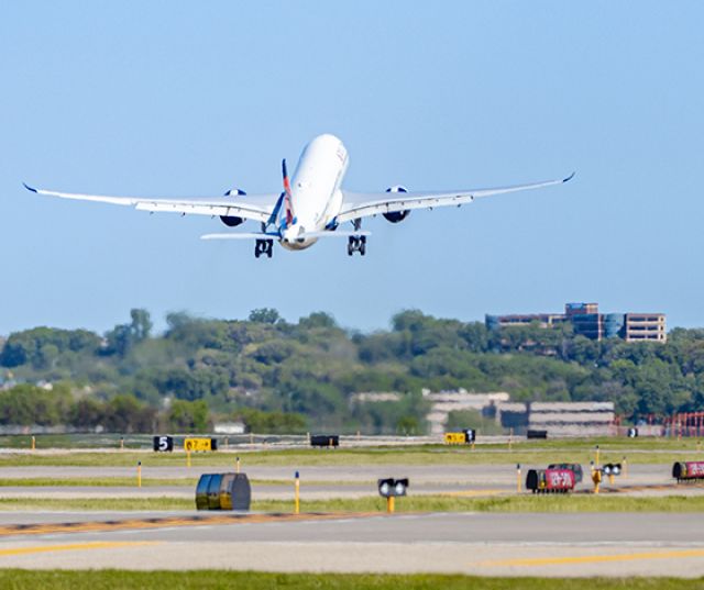
Aircraft Noise
MAC Community Relations: Your Airport Resource
The Community Relations Office is your connection to the MAC. Recognizing the important role our system of airports plays in stimulating a broad, thriving and vibrant community, the MAC Community Relations Office offers a wide range of outreach activities to engage our diverse stakeholders, including addressing airport noise concerns.
For decades, the MAC has been engaging communities, airport operators and the Federal Aviation Administration (FAA) in cooperative efforts to reduce aircraft noise impacts associated with the Minneapolis-St. Paul International Airport (MSP) and the MAC's six reliever airports.
We engage with our communities and stakeholders through airport advisory commissions, long-range planning efforts, airport events, and educational programs.
FAA Procedures
The FAA is in the process of updating departure flight procedures at MSP. To learn more about the FAA’s process and the roles of the MAC and MSP Noise Oversight Committee, click the link below.
Runway Construction
Runway construction work starting this summer will result in runway closures at MSP in 2024 and 2025. Click the link below for more information.


MACNOMS
MACNOMS
Learn More
FlightTracker
Interactive Reports
The MACNOMS system can be broken down into four main components: data collection, data processing, data analysis and publication, and community tools for accessing data.
MSP Quarterly Listening Sessions
MSP Quarterly Listening Sessions
Learn more
The MAC Community Relations Office sponsors quarterly Listening Sessions for residents to receive updates on the MSP Noise Oversight Committee (NOC) and its activities, to be briefed on MSP operational levels and procedures and to have an opportunity to provide comments and voice concerns on aircraft noise issues.
Noise Contours & Land-Use Zoning
Noise Contours & Land-Use Zoning
Learn more
Zoning around airports is regulated by many government agencies – including the Federal Aviation Administration – to achieve a reasonable level of public safety while facilitating compatible community development.
Real Estate Professional and Homebuyer Information
Real Estate Professional and Homebuyer Information
Learn more
The MAC offers tips and resources to help home buyers and real estate professionals assess aircraft activity throughout the twin cities.
Mobile Sound Monitoring
Mobile Sound Monitoring
Learn More
Obtain information about Mobile Noise Monitoring requests for areas surrounding MSP
MSP Runway Closures
MSP Runway Closures
Runway Closures
2024 and 2025 Runway Construction
Because runway closures can have a significant impact on how aircraft operate into and out of MSP, the MAC Community Relations Office shares information about runway closures of 30 minutes or longer at MSP. Link to the runway closure information table below.
Additionally, information about upcoming runway construction that will close runways is provided at the link below.
Aircraft Noise FAQs
Aircraft Noise FAQs
Learn More
Here you'll find answers to your questions and information that will help you better understand the complex issue of aircraft noise.
Reliever Airport Advisory Commissions
Reliever Airport Advisory Commisions
Anoka County-Blaine
Airlake
Flying Cloud
Lake Elmo
St. Paul Downtown
The airport advisory commissions for MAC's reliever airports are comprised of appointed airport users and representatives from the communities that surround these airports. These commissions bring together MAC staff and airport tenants and neighbors to discuss airport development, aircraft operations and noise concerns.
More information about each commission is provided at the links below.
Meet the Fleet
Meet the Fleet
Meet the Fleet
The Meet the Fleet series gives viewers behind-the-scenes information about different aircraft types. The videos feature commentary from pilots sharing interesting facts about specific aircraft, identifying characteristics, common routes flown and up-close footage of the fleet.
Meet the Fleet videos are available at the link below.


Aircraft Noise Documents & Resources
Contact the MAC Community Relations Office
Contact our staff with questions or concerns through this form, or our 24-hour hotline at 612-726-9411.